HiPS2fits Service (astroquery.hips2fits)
Getting started
Query the CDS hips2fits service
The CDS hips2fits service offers a way to extract FITS images from HiPS sky maps. HiPS is an IVOA standard that combines individual images in order to produce a progressive hierarchical sky map describing the whole survey. Please refer to the IVOA paper for more info.
Given an astropy user-defined WCS with a HiPS name, hips2fits will return you the corresponding FITS image (JPG/PNG output formats are also implemented).
See the list of valid HiPS names hosted in CDS here. It is also
possible to use astroquery.mocserver.MOCServerClass.find_datasets() to retrieve the list of HiPSes matching an expression
(e.g. *HST* will return the names of the HST surveys HiPSes).
This package implements two methods:
query_with_wcs()extracting a FITS image from a HiPS and an astropywcs.WCS.See here all the valid HiPS names hosted in CDS.
Examples
With a user defined astropy WCS
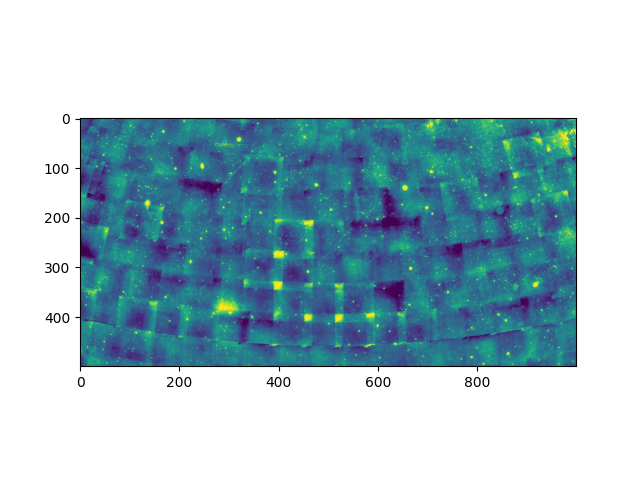
>>> from astroquery.hips2fits import hips2fits
>>> import matplotlib.pyplot as plt
>>> from matplotlib.colors import Colormap
>>> from astropy import wcs as astropy_wcs
>>> # Create a new WCS astropy object
>>> w = astropy_wcs.WCS(header={
...     'NAXIS1': 2000,         # Width of the output fits/image
...     'NAXIS2': 1000,         # Height of the output fits/image
...     'WCSAXES': 2,           # Number of coordinate axes
...     'CRPIX1': 1000.0,       # Pixel coordinate of reference point
...     'CRPIX2': 500.0,        # Pixel coordinate of reference point
...     'CDELT1': -0.18,        # [deg] Coordinate increment at reference point
...     'CDELT2': 0.18,         # [deg] Coordinate increment at reference point
...     'CUNIT1': 'deg',        # Units of coordinate increment and value
...     'CUNIT2': 'deg',        # Units of coordinate increment and value
...     'CTYPE1': 'GLON-MOL',   # galactic longitude, Mollweide's projection
...     'CTYPE2': 'GLAT-MOL',   # galactic latitude, Mollweide's projection
...     'CRVAL1': 0.0,          # [deg] Coordinate value at reference point
...     'CRVAL2': 0.0,          # [deg] Coordinate value at reference point
... })
>>> hips = 'CDS/P/DSS2/red'
>>> result = hips2fits.query_with_wcs(
...    hips=hips,
...    wcs=w,
...    get_query_payload=False,
...    format='jpg',
...    min_cut=0.5,
...    max_cut=99.5,
...    cmap=Colormap('viridis'),
... )
>>> im = plt.imshow(result)
>>> plt.show()

Without WCS
>>> from astroquery.hips2fits import hips2fits
>>> import matplotlib.pyplot as plt
>>> from matplotlib.colors import Colormap
>>> import astropy.units as u
>>> from astropy.coordinates import Longitude, Latitude, Angle
>>> hips = 'CDS/P/DSS2/red'
>>> result = hips2fits.query(
...    hips=hips,
...    width=1000,
...    height=500,
...    ra=Longitude(0 * u.deg),
...    dec=Latitude(20 * u.deg),
...    fov=Angle(80 * u.deg),
...    projection="AIT",
...    get_query_payload=False,
...    format='jpg',
...    min_cut=0.5,
...    max_cut=99.5,
...    cmap=Colormap('viridis'),
... )
>>> im = plt.imshow(result)
>>> plt.show()
Reference/API
astroquery.hips2fits Package
CDS hips2fits Query Tool
- Author:
Matthieu Baumann (matthieu.baumann@astro.unistra.fr)
This package is for querying the CDS hips2fits service, primarily hosted at:
Note: If the access to hips2fits was helpful for your research work, the following acknowledgment would be appreciated:
This research has made use of the hips2fits, a tool developed at CDS, Strasbourg, France aiming at extracting
FITS images from HiPS sky maps with respect to a WCS.
Classes
|
|
|
Configuration parameters for |